About Tirupattur District and Its History
- Tirupattur District was bifurcated from Vellore District on 15th August 2019.
- A research report says that the name "Tirupathur" was derived from the fact that there were 10 temples in 8 directions from Adiyur to Kodiyur, Tirupathur was called Brahmapuram, Thiruperur, Thiruvanapuram during the reign of many kings, and in the 14th century Vijayanagara kings changed the name from Thiruvanapuram to Tirupathur.
- The city of Tirupattur is surrounded by two big mountains namely Javadhu Hills and Yelagiri Hills. Javadhu Hill is a mesmerizing mountain that thrills the onlookers with its scenic waterfalls, streams and forests. Bhiman Falls and Amirthi Zoological Park are tourist attractions of this mountain. Javadhu Hill gives rise to rivers like Cheyyar, Araniyar, Kamandala Naganathi River and Mrikanda River.
- Most of the hill dwellers belong to the Malayali tribe. Their main occupation is agriculture. This hill is the best sandalwood growing land. Thus Asia's 2nd largest sandalwood warehouse was set up at Tirupattur.
- The "Biryani" made in Ambur Nagar in this district is world famous. Leather factories are established here, which not only earns a lot of foreign exchange, but also provides employment to the people here.
- Jolarpet railway station is a major junction connecting cities like Thiruvananthapuram, Bangalore and Mumbai.
- During the British rule, Tirupattur district was formed in 1790 and Kindersley was appointed as its first Governor and remained in charge till 3.4.1792.
- Thereafter, the united Salem district was formed, with Tirupattur as its capital. The collector's office, built by the British, is now a railway station.
Tirupattur District Complete Details
| Tirupattur District | Information |
|---|---|
| Total Area | 1,797.92 sq.kms |
| Total Population | 1,111,812 |
| Population Density | 620/sq.km |
| Average Annual Rainfall | 877 mm |
| Climate Condition | 36*c Maximum and 26*c Minimum |
| STD Landline Code | 04179 |
| Pin Codes | 635*** |
| Nearest Airport | Bengaluru Airport (75.6 km from Tirupattur) |
| Bus Stand | Tirupattur Bus Stand, Tirupattur |
| Railway Station | Tiruppattur Railway Station, Tirupattur |
| Tirupattur District Court Email id | vlrtpt.jmc1-tn@indiancourts.nic.in |
| Collector Office Phone Number, Email id | 6381515099, collr-tpt@gov.in |
| District Health Officer Dial Number, Email id | 8939920061, dphtpt@nic.in |
| District Education Office Telephone Number | 9385202001, ceotptr2020@gmail.com |
| District Employment Office Number | |
| Revenue Officer Phone Number, Email id | 9442474454, dro.tptr@tn.gov.in |
| Registrar Office Phone Number, Email id | 04174 243640, sroambur@tnreginet.net |
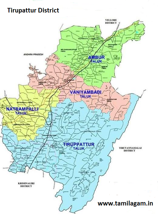
| District Taluk List | 4 Taluks (Tirupathur, Natrampalli, Vaniyambadi, and Ambur) |
| Tirupattur Emergency Helpline Numbers | Click Here Tirupattur Emergency Numbers |
Tirupattur Famous Tourist Attractions & Places of Interest
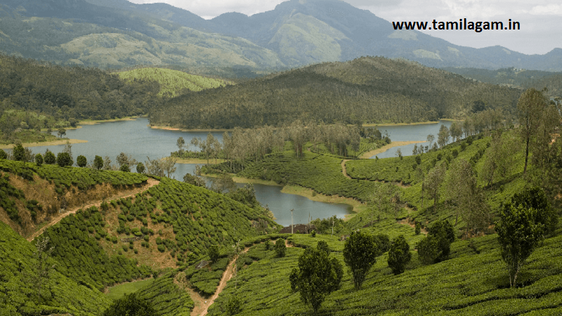
Yelagiri Hills
Yelagiri, a part of Jawadhu mountain range. Also known as Poor people's Ooty. This place is at a distance of
32 km from Jolarpettai. Tribal people live in many villages on this hill. A beautiful park and a wildlife
gallery are set up here to entertain the tourists. Visitors can buy various types of herbs and herbal products
here. A Murugan temple is also located on this hill.
Jalagamparai Water Falls
Jalagambarai Falls has a beautiful environment Located in the Yelagiri Hills. It is located at a distance of
40 minutes drive from Tirupattur. The Murugan temple here is very famous in this hill.
Tirupattur District Political Map Directions :